
Landslides remain one of the most significant natural hazards affecting infrastructure, transportation networks, mining operations, and communities worldwide. As climate change, heavy rainfall, and expanding development increase the likelihood of slope instability, organizations need monitoring solutions that provide accurate, continuous, and real-time information. Traditional inspections alone cannot deliver the level of visibility required to manage these risks effectively.
Avacam is helping transform geotechnical monitoring through remote landslide monitoring with industrial devices. By combining rugged hardware, AI-powered analytics, and intelligent timelapse technology, Avacam enables organizations to detect terrain changes early and respond before small movements become major hazards.
The Challenge of Monitoring Unstable Slopes
Monitoring steep slopes and remote landscapes is difficult. Many high-risk locations are exposed to severe weather, limited accessibility, and changing environmental conditions. Manual inspections may only occur periodically, leaving long gaps between observations.
Continuous remote monitoring eliminates these limitations by providing uninterrupted visibility into terrain conditions. Engineers can monitor slopes around the clock without exposing personnel to hazardous environments.
Industrial Devices Built for Reliability
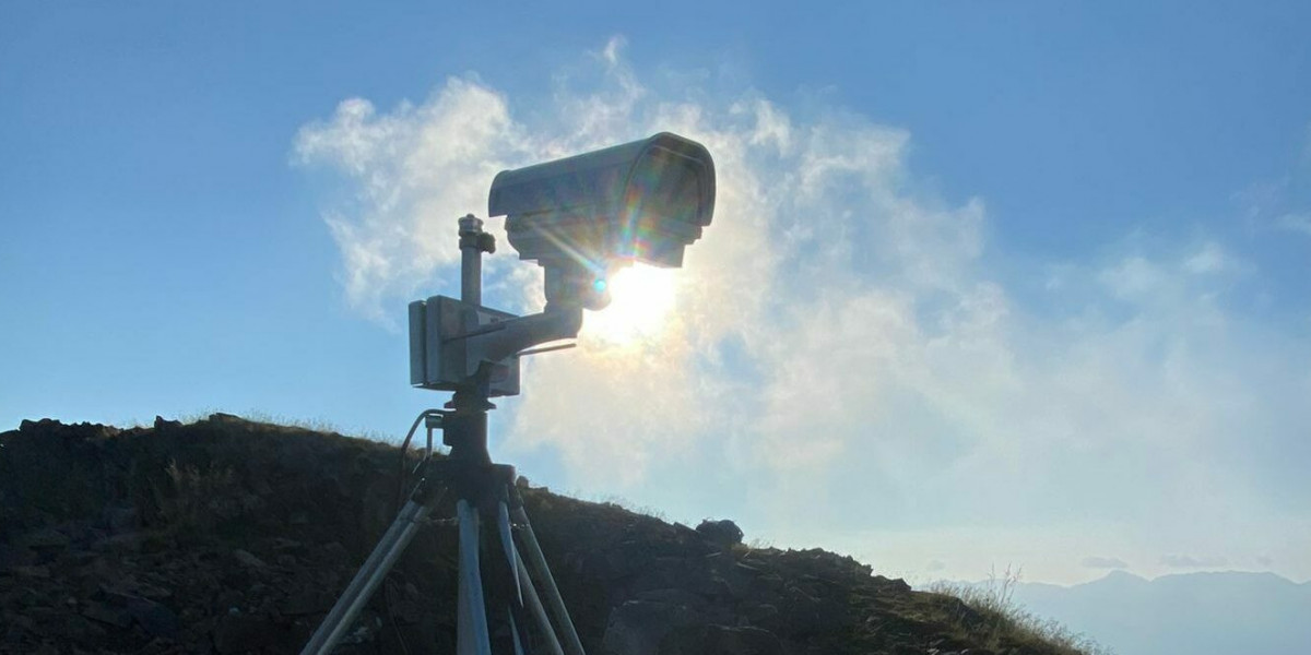
Successful monitoring depends on equipment that performs consistently in demanding conditions. Avacam uses industrial-grade monitoring devices engineered for long-term deployment in mountains, construction sites, mines, highways, and other critical locations.
These systems are designed to withstand rain, snow, dust, wind, and temperature extremes while delivering dependable image capture and monitoring performance throughout the year.
AI Enhances Hazard Detection
Remote monitoring becomes even more valuable when combined with artificial intelligence. Avacam's AI-powered analytics automatically evaluate monitoring data, identify terrain movement, and detect unusual patterns that could indicate increasing landslide risk.
Automated alerts enable engineers to investigate potential issues quickly, improving response times and supporting proactive maintenance strategies.
Intelligent Timelapse for Long-Term Analysis
Understanding gradual geological change requires more than isolated images. Avacam's intelligent timelapse technology captures high-resolution images at regular intervals, creating a visual timeline of terrain behavior.
These visual records allow experts to study erosion, slope movement, vegetation changes, and other environmental factors that influence landslide activity. Historical data also strengthens engineering reports and long-term risk assessments.
Real-Time Access to Critical Information
Avacam provides secure remote access to monitoring data from virtually anywhere. Engineers, project managers, and decision-makers can review live images, compare historical observations, and receive instant notifications when conditions change.
This accessibility improves collaboration, supports faster decision-making, and ensures that critical information is always available when needed.
Applications Across Industries
Avacam's remote landslide monitoring solutions support numerous sectors, including:
Infrastructure and civil engineering
Mining and quarry operations
Highway and railway monitoring
Construction projects
Dam and embankment safety
Environmental monitoring
Geotechnical engineering
Mountain risk management
The flexibility of the platform allows organizations to implement reliable monitoring across a wide variety of projects and environments.
Benefits of Choosing Avacam
Organizations using Avacam's monitoring technology benefit from:
Continuous remote terrain observation
Industrial-grade reliability
AI-powered hazard detection
Intelligent timelapse documentation
Early warning capabilities
Reduced need for manual inspections
Improved operational safety
Better protection of critical infrastructure
These advantages help organizations reduce costs while improving long-term resilience.
Conclusion
As environmental challenges continue to grow, continuous terrain monitoring has become an essential part of modern infrastructure management. Avacam combines industrial-grade monitoring devices, AI-powered analytics, intelligent timelapse technology, and real-time terrain observation to deliver dependable remote landslide monitoring solutions.
By enabling early hazard detection and data-driven decision-making, Avacam helps organizations improve safety, reduce geological risks, and protect critical infrastructure in even the most demanding environments.